 Question Constellation Sign up for free
 AQA · GCSE · Geography · Higher
Relief and Drainage North of Railway
Study Figure 2 in the resources booklet, ‘The proposed Tudeley Village development’.
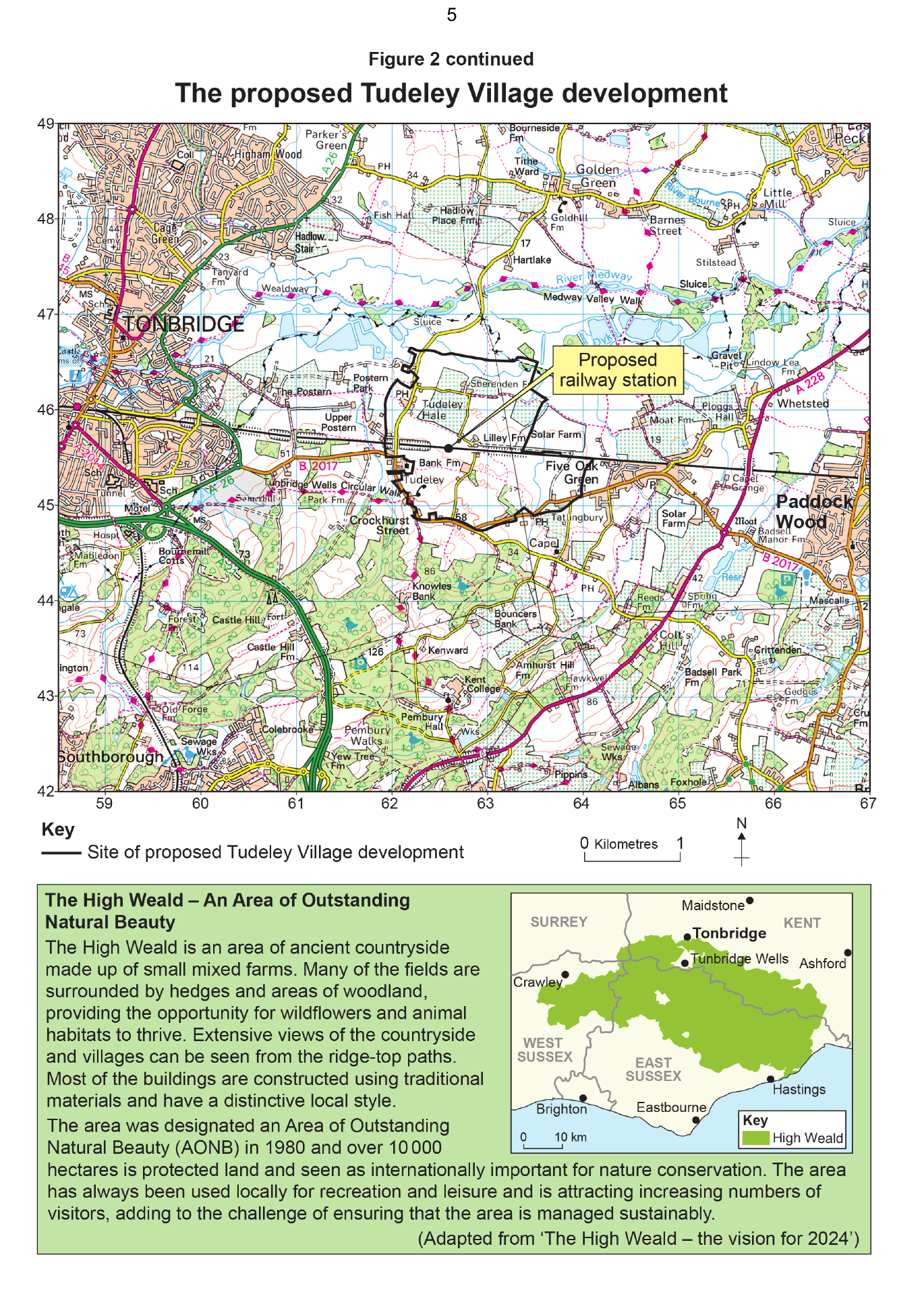
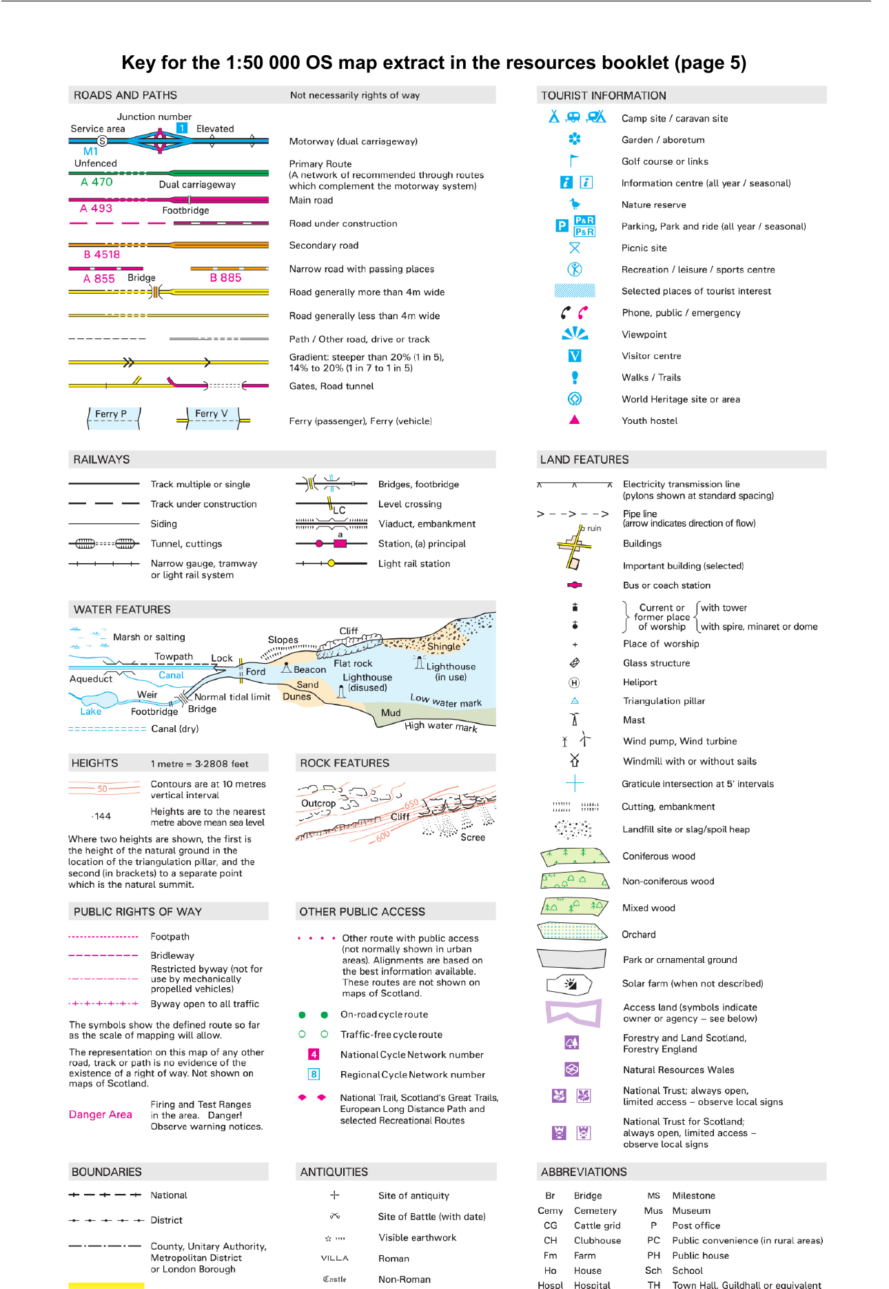
Using the Ordnance Survey map, describe the physical geography (relief and drainage) of the area north of the Tonbridge to Paddock Wood railway line.
Write your answer first. You can study the marking guidance whenever you need it.
Study the marking See what earns credit and compare it with a full-mark answer.
Marking points
- 1 Identifies relevant physical geography north of the named railway line, rather than listing human features.
- 2 Describes relief and/or drainage using accurate OS map evidence.
- 3 For Level 2, adds precision or development through heights, contours, named rivers, direction, confluence, ponds/lakes or ditches.
Full-mark answer
North of the railway the land is mainly low-lying and fairly flat or gently sloping, with spot heights such as 17 m and 19 m and slightly higher land farther north, including about 32 m. The Rivers Medway and Bourne flow generally east or north-east and the Bourne joins the Medway. There are also several ponds or lakes and drainage ditches, with small areas of woodland near some water features.
Why this answer loses marks
The area has settlements, roads and a railway.
These are human features; the question requires relief and drainage evidence from the area north of the railway line.